 vesseltracker.com
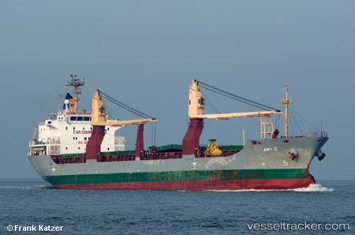
Sider Amy
Current StatusWhere is the vessel?
Sider Amy is currently in Near YALOVA, based on AIS data received less than 1h ago.
Latest AIS update:
Current position: 40.72449° N, 29.48058° E (Near YALOVA)
Average speed (last 7 days): Loading…
Average speed (last 30 days): Loading…
Vessel profile: Sider Amy is a Multi Purpose Carrier with dimensions 22m x 136m.
This page combines live AIS, route history, probable destination signals, nearby traffic, and port activity for practical vessel monitoring.
The current position of vessel Sider Amy is 40.72449 lat / 29.48058 lng. Updated: 2026-05-14 16:07:11 UTCNearest reference points:
- Near YALOVA
- Near Yilport
- Near Diliskelesi
Details:
Live Vessel Sider Amy Analytics (details, animations, etc.)
Recent AIS points (UTC):
2026-05-14 13:34:11 UTC · 40.72450, 29.48056 · SOG 0 kn · COG 150°2026-05-14 13:52:11 UTC · 40.72449, 29.48059 · SOG 0 kn · COG 150°
2026-05-14 16:04:08 UTC · 40.72446, 29.48060 · SOG 0 kn · COG 150°
2026-05-14 16:07:11 UTC · 40.72449, 29.48058 · SOG 0 kn · COG 150°