 vesseltracker.com
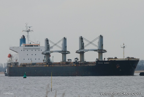
 FUDA
FUDA
Current Status
Where is the vessel?
FUDA is currently in 21 nm W of ROENNE, based on AIS data received less than 1h ago.
Latest AIS update:
Current position: 55.02085° N, 14.10262° E (21 nm W of ROENNE)
Average speed (last 7 days): Loading…
Average speed (last 30 days): Loading…
Vessel profile: FUDA is a Bulk Carrier with dimensions 32m x 190m.
This page combines live AIS, route history, probable destination signals, nearby traffic, and port activity for practical vessel monitoring.
The current position of vessel FUDA is 55.02085 lat / 14.10262 lng. Updated: 2026-04-27 19:28:40 UTCNearest reference points:
- Near Baabe (Ostseebad)
- Near SASSNITZ
- Near Lietzow
Currently sailing under the flag of Panama ![]()
FUDA built in 2007 year
Deadweight:
56039 tDetails:
Live Vessel FUDA Analytics (details, animations, etc.)
Recent AIS points (UTC):
2026-04-27 16:15:31 UTC · 54.81942, 13.11159 · SOG 10.9 kn · COG 72°2026-04-27 16:46:00 UTC · 54.84879, 13.26397 · SOG 11 kn · COG 71°
2026-04-27 17:39:41 UTC · 54.89838, 13.53563 · SOG 11 kn · COG 71°
2026-04-27 19:28:40 UTC · 55.02085, 14.10262 · SOG 11.5 kn · COG 51°