 vesseltracker.com
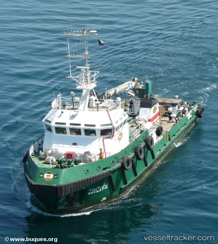
Nakilat Vi
Current StatusWhere is the vessel?
Nakilat Vi is currently in 16 nm N of Mina Saud, based on AIS data received about 21h ago.
Latest AIS update:
Current position: 28.99697° N, 48.50133° E (16 nm N of Mina Saud)
Average speed (last 7 days): Loading…
Average speed (last 30 days): Loading…
Vessel profile: Nakilat Vi is a Utility Vessel with dimensions 9m x 35m.
This page combines live AIS, route history, probable destination signals, nearby traffic, and port activity for practical vessel monitoring.
The current position of vessel Nakilat Vi is 28.99697 lat / 48.50133 lng. Updated: 2026-05-13 07:14:24 UTCNearest reference points:
- Near Mina Al Zour
- Near SHUAIBA
- Near Mina Az Zawr
Details:
Live Vessel Nakilat Vi Analytics (details, animations, etc.)
Recent AIS points (UTC):
2026-05-13 07:14:24 UTC · 28.99697, 48.50133 · SOG 0.3 kn · COG 322°2026-05-13 07:14:24 UTC · 28.99697, 48.50133 · SOG 0.3 kn · COG 322°
2026-05-13 07:14:24 UTC · 28.99697, 48.50133 · SOG 0.3 kn · COG 322°
2026-05-13 07:14:24 UTC · 28.99697, 48.50133 · SOG 0.3 kn · COG 322°