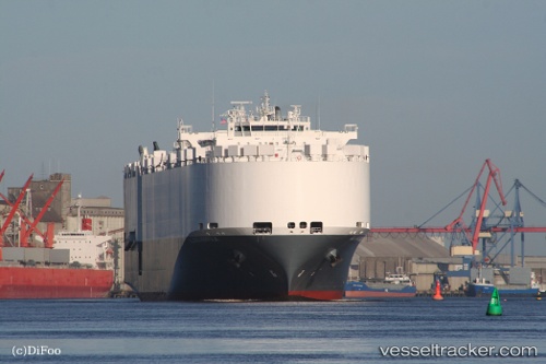
Alliance Norfolk
Current StatusWhere is the vessel?
Alliance Norfolk is currently in 141 nm E of Saint George, based on AIS data received about 16h ago.
Latest AIS update:
Current position: 31.80090° N, 61.99312° W (141 nm E of Saint George)
Average speed (last 7 days): Loading…
Average speed (last 30 days): Loading…
Vessel profile: Alliance Norfolk is a Vehicles Carrier with dimensions 22m x 200m.
This page combines live AIS, route history, probable destination signals, nearby traffic, and port activity for practical vessel monitoring.
The current position of vessel Alliance Norfolk is 31.80090 lat / -61.99312 lng. Updated: 2026-05-24 05:21:05 UTCNearest reference points:
- 247 nm E of Saint George
Details:
Live Vessel Alliance Norfolk Analytics (details, animations, etc.)
Recent AIS points (UTC):
2026-05-24 01:25:55 UTC · 31.42050, -63.14367 · SOG 15.9 kn · COG 71°2026-05-24 04:20:07 UTC · 31.69607, -62.29082 · SOG 16.3 kn · COG 68°
2026-05-24 04:58:35 UTC · 31.76207, -62.10153 · SOG 16 kn · COG 68°
2026-05-24 05:21:05 UTC · 31.80090, -61.99312 · SOG 16.1 kn · COG 68°