 vesseltracker.com
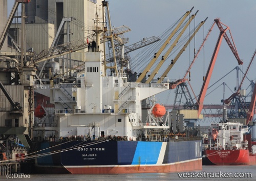
Ionic Storm
Current StatusWhere is the vessel?
Ionic Storm is currently in Near Vishakhapatnam, based on AIS data received less than 1h ago.
Latest AIS update:
Current position: 17.70110° N, 83.28092° E (Near Vishakhapatnam)
Average speed (last 7 days): Loading…
Average speed (last 30 days): Loading…
Vessel profile: Ionic Storm is a Bulk Carrier with dimensions 32m x 187m.
This page combines live AIS, route history, probable destination signals, nearby traffic, and port activity for practical vessel monitoring.
The current position of vessel Ionic Storm is 17.70110 lat / 83.28092 lng. Updated: 2026-05-16 07:59:29 UTCNearest reference points:
- Near Vishakhapatnam
- Near Wipro Sez/Resapuvanipalem
- Near Gopalpur
Details:
Live Vessel Ionic Storm Analytics (details, animations, etc.)
Recent AIS points (UTC):
2026-05-16 04:17:30 UTC · 17.70110, 83.28092 · SOG 0 kn · COG 172°2026-05-16 05:53:27 UTC · 17.70110, 83.28091 · SOG 0 kn · COG 172°
2026-05-16 07:59:29 UTC · 17.70110, 83.28092 · SOG 0 kn · COG 172°
2026-05-16 07:59:29 UTC · 17.70110, 83.28092 · SOG 0 kn · COG 172°