 vesseltracker.com
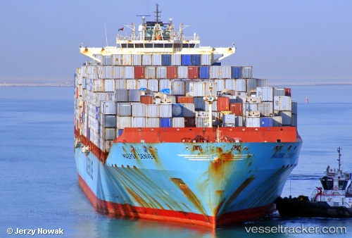
 Maersk Denver
Current Status
Where is the vessel?
Maersk Denver is currently in 34 nm E of Indialantic, based on AIS data received about 1h ago.
Latest AIS update:
Current position: 28.25167° N, 79.94500° W (34 nm E of Indialantic)
Average speed (last 7 days): Loading…
Average speed (last 30 days): Loading…
Vessel profile: Maersk Denver is a Container Ship with dimensions 299m x 299m.
This page combines live AIS, route history, probable destination signals, nearby traffic, and port activity for practical vessel monitoring.
The current position of vessel Maersk Denver is 28.25167 lat / -79.94500 lng. Updated: 2026-05-14 06:11:10 UTCNearest reference points:
- 27 nm NE of Port Canaveral
- Near Indian Harbour Beach
- Near Port Canaveral
Currently sailing under the flag of USA ![]()
Maersk Denver built in 2007 year
Deadweight:
84771 tDetails:
Live Vessel Maersk Denver Analytics (details, animations, etc.)
Recent AIS points (UTC):
2026-05-14 02:01:25 UTC · 29.11833, -80.07000 · SOG 13 kn · COG -1°2026-05-14 03:58:47 UTC · 28.71167, -80.00333 · SOG 12 kn · COG -1°
2026-05-14 04:22:51 UTC · 28.62833, -79.99166 · SOG 13 kn · COG -1°
2026-05-14 06:11:10 UTC · 28.25167, -79.94500 · SOG 12 kn · COG -1°