 vesseltracker.com
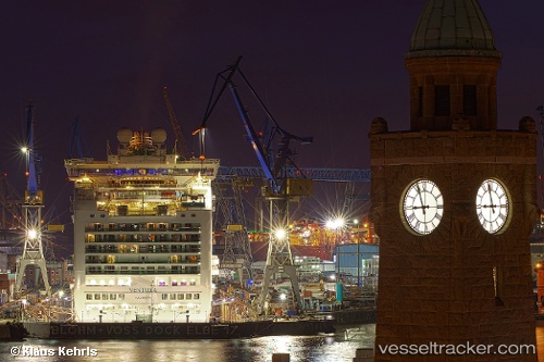
 Ventura
Current Status
Where is the vessel?
Ventura is currently in Near Las Palmas, based on AIS data received less than 1h ago.
Latest AIS update:
Current position: 28.13833° N, 15.42333° W (Near Las Palmas)
Average speed (last 7 days): Loading…
Average speed (last 30 days): Loading…
Vessel profile: Ventura is a Cruise Ship with dimensions 289m x 36m.
This page combines live AIS, route history, probable destination signals, nearby traffic, and port activity for practical vessel monitoring.
The current position of vessel Ventura is 28.13833 lat / -15.42333 lng. Updated: 2026-05-16 12:09:29 UTCNearest reference points:
- Near Las Palmas
- Near Las Palmas de Gran Canaria
- Near TALIARTE
Currently sailing under the flag of Bermuda ![]()
Ventura built in 2008 year
Deadweight:
8044 tDetails:
Live Vessel Ventura Analytics (details, animations, etc.)
Recent AIS points (UTC):
2026-05-16 07:45:00 UTC · 28.13899, -15.42324 · SOG 0 kn · COG 135°2026-05-16 10:03:10 UTC · 28.13833, -15.42333 · SOG 0 kn · COG -1°
2026-05-16 10:09:02 UTC · 28.13899, -15.42323 · SOG 0 kn · COG 135°
2026-05-16 12:09:29 UTC · 28.13833, -15.42333 · SOG 0 kn · COG -1°