 vesseltracker.com
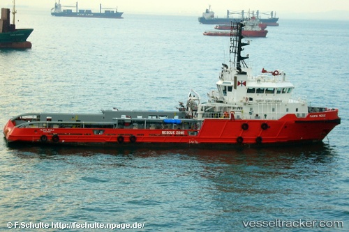
Thanh Long
Current StatusWhere is the vessel?
Thanh Long is currently in Near Bach Ho, based on AIS data received about 3d ago.
Latest AIS update:
Current position: 9.97392° N, 107.94811° E (Near Bach Ho)
Average speed (last 7 days): Loading…
Average speed (last 30 days): Loading…
Vessel profile: Thanh Long is a Offshore Tug Supply Ship with dimensions 13m x 56m.
This page combines live AIS, route history, probable destination signals, nearby traffic, and port activity for practical vessel monitoring.
The current position of vessel Thanh Long is 9.97392 lat / 107.94811 lng. Updated: 2026-05-11 18:22:38 UTCNearest reference points:
- 30 nm NW of Bach Ho
- Near Rang Dong
- 15 nm SE of Bà Ria
Details:
Live Vessel Thanh Long Analytics (details, animations, etc.)
Recent AIS points (UTC):
2026-05-11 18:22:38 UTC · 9.97392, 107.94811 · SOG 1.6 kn · COG 49°2026-05-11 18:22:38 UTC · 9.97392, 107.94811 · SOG 1.6 kn · COG 49°
2026-05-11 18:22:38 UTC · 9.97392, 107.94811 · SOG 1.6 kn · COG 49°
2026-05-11 18:22:38 UTC · 9.97392, 107.94811 · SOG 1.6 kn · COG 49°