 vesseltracker.com
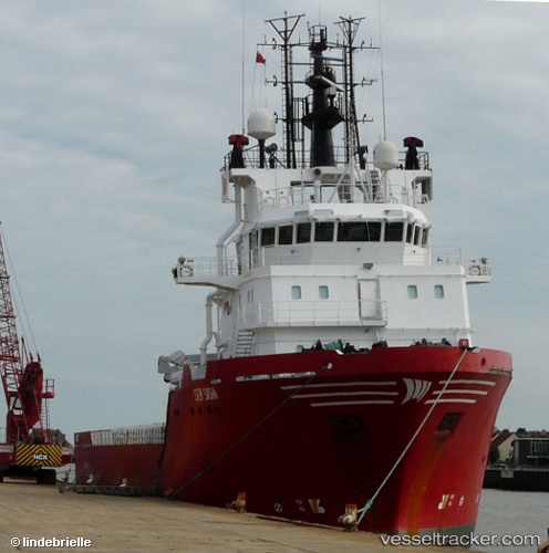
 Altan
Altan
Current Status
Where is the vessel?
Altan is currently in 25 nm E of El Maan, based on AIS data received less than 1h ago.
Latest AIS update:
Current position: 2.17527° N, 46.01514° E (25 nm E of El Maan)
Average speed (last 7 days): Loading…
Average speed (last 30 days): Loading…
Vessel profile: Altan is a Offshore Tug Supply Ship with dimensions 73m x 17m.
This page combines live AIS, route history, probable destination signals, nearby traffic, and port activity for practical vessel monitoring.
The current position of vessel Altan is 2.17527 lat / 46.01514 lng. Updated: 2026-05-14 17:53:24 UTCNearest reference points:
- 122 nm SE of El Maan
Currently sailing under the flag of Turkey ![]()
Altan built in 2005 year
Deadweight:
3555 tDetails:
Live Vessel Altan Analytics (details, animations, etc.)
Recent AIS points (UTC):
2026-05-14 14:09:34 UTC · 2.02135, 45.34767 · SOG 6.8 kn · COG 143°2026-05-14 15:51:33 UTC · 2.06333, 45.63537 · SOG 12.7 kn · COG 75°
2026-05-14 16:20:29 UTC · 2.09678, 45.72513 · SOG 12.1 kn · COG 75°
2026-05-14 17:53:24 UTC · 2.17527, 46.01514 · SOG 11.8 kn · COG 84°