 vesseltracker.com
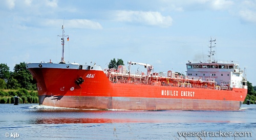
Abai
Current StatusWhere is the vessel?
Abai is currently in Near Aktau, based on AIS data received less than 1h ago.
Latest AIS update:
Current position: 43.56045° N, 51.14060° E (Near Aktau)
Average speed (last 7 days): Loading…
Average speed (last 30 days): Loading…
Vessel profile: Abai is a Oil Products Tanker with dimensions 17m x 154m.
This page combines live AIS, route history, probable destination signals, nearby traffic, and port activity for practical vessel monitoring.
The current position of vessel Abai is 43.56045 lat / 51.14060 lng. Updated: 2026-04-28 09:53:55 UTCNearest reference points:
- 12 nm S of Aktau
- 24 nm W of Kuryk
- 35 nm W of Kuryk
Details:
Live Vessel Abai Analytics (details, animations, etc.)
Recent AIS points (UTC):
2026-04-28 06:14:55 UTC · 43.56043, 51.14062 · SOG 0.3 kn · COG 353°2026-04-28 07:17:53 UTC · 43.56060, 51.14137 · SOG 0.2 kn · COG 334°
2026-04-28 08:11:54 UTC · 43.56045, 51.14062 · SOG 0.1 kn · COG 350°
2026-04-28 09:53:55 UTC · 43.56045, 51.14060 · SOG 0.1 kn · COG 355°