 vesseltracker.com
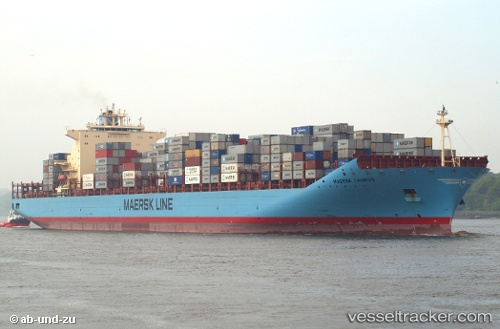
Maersk Taurus
Current StatusWhere is the vessel?
Maersk Taurus is currently in 70 nm S of Los Cabos, based on AIS data received less than 1h ago.
Latest AIS update:
Current position: 21.77778° N, 109.43524° W (70 nm S of Los Cabos)
Average speed (last 7 days): Loading…
Average speed (last 30 days): Loading…
Vessel profile: Maersk Taurus is a Container Ship with dimensions 43m x 332m.
This page combines live AIS, route history, probable destination signals, nearby traffic, and port activity for practical vessel monitoring.
The current position of vessel Maersk Taurus is 21.77778 lat / -109.43524 lng. Updated: 2026-05-15 05:27:04 UTCNearest reference points:
- 67 nm S of Los Cabos
- Near Los Cabos
- Near San Jose del Cabo
Details:
Live Vessel Maersk Taurus Analytics (details, animations, etc.)
Recent AIS points (UTC):
2026-05-15 01:27:04 UTC · 22.26039, -110.23566 · SOG 13.3 kn · COG 122°2026-05-15 04:07:25 UTC · 21.93146, -109.70115 · SOG 13.2 kn · COG 122°
2026-05-15 04:49:25 UTC · 21.85019, -109.56061 · SOG 13.1 kn · COG 124°
2026-05-15 05:27:04 UTC · 21.77778, -109.43524 · SOG 12.7 kn · COG 124°