 vesseltracker.com
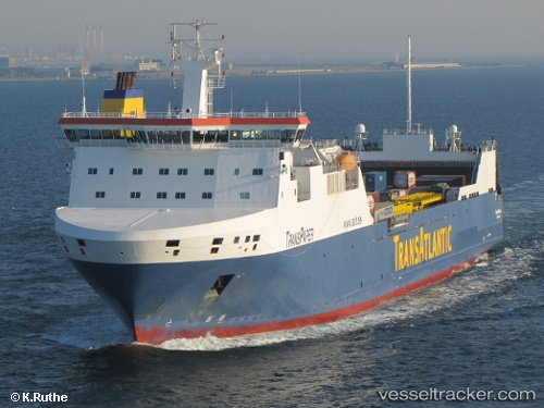
 Tavastland
Current Status
Where is the vessel?
Tavastland is currently in 24 nm NW of Korsnäs, based on AIS data received less than 1h ago.
Latest AIS update:
Current position: 62.99359° N, 20.42343° E (24 nm NW of Korsnäs)
Average speed (last 7 days): Loading…
Average speed (last 30 days): Loading…
Vessel profile: Tavastland is a Ro Ro Cargo Ship with dimensions 190m x 26m.
This page combines live AIS, route history, probable destination signals, nearby traffic, and port activity for practical vessel monitoring.
The current position of vessel Tavastland is 62.99359 lat / 20.42343 lng. Updated: 2026-05-14 03:55:32 UTCNearest reference points:
- 20 nm S of HOLMSUND
- Near Rouhu
Currently sailing under the flag of Sweden ![]()
Tavastland built in 2006 year
Deadweight:
15960 tDetails:
Live Vessel Tavastland Analytics (details, animations, etc.)
Recent AIS points (UTC):
2026-05-14 00:14:42 UTC · 63.62672, 21.14005 · SOG 13 kn · COG 221°2026-05-14 01:34:53 UTC · 63.46973, 20.63925 · SOG 13.1 kn · COG 207°
2026-05-14 02:07:13 UTC · 63.37330, 20.49377 · SOG 13 kn · COG 214°
2026-05-14 03:55:32 UTC · 62.99359, 20.42343 · SOG 13 kn · COG 177°