 vesseltracker.com
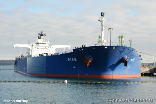
 SPETSA
Current Status
Where is the vessel?
SPETSA is currently in 12 nm N of Port Said, based on AIS data received less than 1h ago.
Latest AIS update:
Current position: 31.47192° N, 32.31080° E (12 nm N of Port Said)
Average speed (last 7 days): Loading…
Average speed (last 30 days): Loading…
Vessel profile: SPETSA is a Crude Oil Tanker with dimensions m x m.
This page combines live AIS, route history, probable destination signals, nearby traffic, and port activity for practical vessel monitoring.
The current position of vessel SPETSA is 31.47192 lat / 32.31080 lng. Updated: 2026-05-13 22:42:47 UTCNearest reference points:
- 14 nm N of Port Said
- 15 nm N of Port Said
- 16 nm N of Port Said
Currently sailing under the flag of Liberia ![]()
Details:
Live Vessel SPETSA Analytics (details, animations, etc.)
Recent AIS points (UTC):
2026-05-13 19:15:35 UTC · 31.47068, 32.30982 · SOG 0.1 kn · COG 331°2026-05-13 20:15:45 UTC · 31.47072, 32.30983 · SOG 0 kn · COG 329°
2026-05-13 21:33:44 UTC · 31.47098, 32.31028 · SOG 0 kn · COG 317°
2026-05-13 22:42:47 UTC · 31.47192, 32.31080 · SOG 0.1 kn · COG 285°