 vesseltracker.com
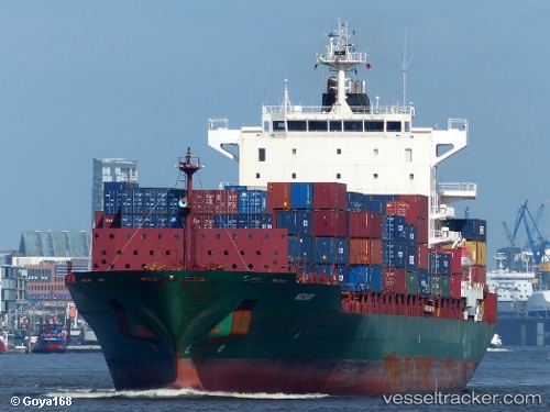
 MOZART
Current Status
Where is the vessel?
MOZART is currently in 10 nm SE of HELGOLAND, based on AIS data received less than 1h ago.
Latest AIS update:
Current position: 54.05251° N, 8.09342° E (10 nm SE of HELGOLAND)
Average speed (last 7 days): Loading…
Average speed (last 30 days): Loading…
Vessel profile: MOZART is a Container Ship with dimensions 222m x 30m.
This page combines live AIS, route history, probable destination signals, nearby traffic, and port activity for practical vessel monitoring.
The current position of vessel MOZART is 54.05251 lat / 8.09342 lng. Updated: 2026-04-30 11:48:23 UTCNearest reference points:
- 10 nm E of Wangerooge
- Near Wangerooge
- Near Helgoland
Currently sailing under the flag of LR ![]()
MOZART built in 2007 year
Deadweight:
39339 tDetails:
Live Vessel MOZART Analytics (details, animations, etc.)
Recent AIS points (UTC):
2026-04-30 07:54:35 UTC · 54.05138, 8.09773 · SOG 0 kn · COG 275°2026-04-30 09:57:24 UTC · 54.05140, 8.09784 · SOG 0 kn · COG 271°
2026-04-30 10:12:22 UTC · 54.05143, 8.09777 · SOG 0 kn · COG 269°
2026-04-30 11:48:23 UTC · 54.05251, 8.09342 · SOG 0.3 kn · COG 169°