 vesseltracker.com
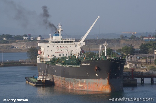
 WEST HORIZON
Current Status
Where is the vessel?
WEST HORIZON is currently in Near Marsa Bashayer, based on AIS data received about 1d ago.
Latest AIS update:
Current position: 19.48518° N, 37.31257° E (Near Marsa Bashayer)
Average speed (last 7 days): Loading…
Average speed (last 30 days): Loading…
Vessel profile: WEST HORIZON is a Oil/Chemical Tanker with dimensions m x m.
This page combines live AIS, route history, probable destination signals, nearby traffic, and port activity for practical vessel monitoring.
The current position of vessel WEST HORIZON is 19.48518 lat / 37.31257 lng. Updated: 2026-04-24 14:13:18 UTCNearest reference points:
- Near Port Sudan
- 53 nm SW of SHUAIBAH
- 64 nm W of Tusdeer Free Zone
Currently sailing under the flag of Palau ![]()
Details:
Live Vessel WEST HORIZON Analytics (details, animations, etc.)
Recent AIS points (UTC):
2026-04-24 14:13:18 UTC · 19.48518, 37.31257 · SOG 0 kn · COG 88°2026-04-24 14:13:18 UTC · 19.48518, 37.31257 · SOG 0 kn · COG 88°
2026-04-24 14:13:18 UTC · 19.48518, 37.31257 · SOG 0 kn · COG 88°
2026-04-24 14:13:18 UTC · 19.48518, 37.31257 · SOG 0 kn · COG 88°