 vesseltracker.com
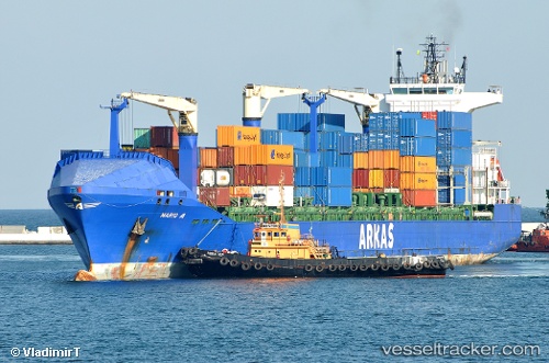
 Mario A
Current Status
Where is the vessel?
Mario A is currently in 32 nm SW of Grand Lahou, based on AIS data received about 2h ago.
Latest AIS update:
Current position: 4.64339° N, 5.22268° W (32 nm SW of Grand Lahou)
Average speed (last 7 days): Loading…
Average speed (last 30 days): Loading…
Vessel profile: Mario A is a Container Ship with dimensions 183m x 184m.
This page combines live AIS, route history, probable destination signals, nearby traffic, and port activity for practical vessel monitoring.
The current position of vessel Mario A is 4.64339 lat / -5.22268 lng. Updated: 2026-04-19 03:45:25 UTCNearest reference points:
- Near Espoir
- Near Vridi
- Near Abidjan
Currently sailing under the flag of Malta ![]()
Mario A built in 2007 year
Deadweight:
22016 tDetails:
Live Vessel Mario A Analytics (details, animations, etc.)
Recent AIS points (UTC):
2026-04-18 21:23:24 UTC · 5.01204, -4.07012 · SOG 11.7 kn · COG 227°2026-04-19 00:08:25 UTC · 4.84333, -4.57167 · SOG 11 kn · COG -1°
2026-04-19 01:56:57 UTC · 4.74236, -4.89709 · SOG 11.1 kn · COG 252°
2026-04-19 03:45:25 UTC · 4.64339, -5.22268 · SOG 11 kn · COG 253°