 vesseltracker.com
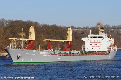
 SIDER BILBAO
Current Status
Where is the vessel?
SIDER BILBAO is currently in Near El Altet, based on AIS data received less than 1h ago.
Latest AIS update:
Current position: 38.32953° N, 0.49802° W (Near El Altet)
Average speed (last 7 days): Loading…
Average speed (last 30 days): Loading…
Vessel profile: SIDER BILBAO is a General Cargo Ship with dimensions 137m x 21m.
This page combines live AIS, route history, probable destination signals, nearby traffic, and port activity for practical vessel monitoring.
The current position of vessel SIDER BILBAO is 38.32953 lat / -0.49802 lng. Updated: 2026-05-14 14:05:31 UTCNearest reference points:
- Near El Altet
- Near Campello
- Near Villajoyosa
Currently sailing under the flag of Portugal (MAR) ![]()
SIDER BILBAO built in 2007 year
Deadweight:
14184 tDetails:
Live Vessel SIDER BILBAO Analytics (details, animations, etc.)
Recent AIS points (UTC):
2026-05-14 10:35:29 UTC · 38.32953, -0.49803 · SOG 0 kn · COG 115°2026-05-14 11:35:30 UTC · 38.32953, -0.49803 · SOG 0 kn · COG 115°
2026-05-14 13:38:31 UTC · 38.32952, -0.49799 · SOG 0 kn · COG 115°
2026-05-14 14:05:31 UTC · 38.32953, -0.49802 · SOG 0 kn · COG 115°