 vesseltracker.com
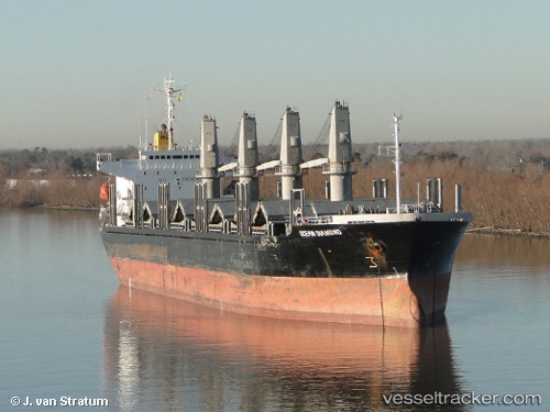
Manta Hatice
Current StatusWhere is the vessel?
Manta Hatice is currently in Near Concepcion del Uruguay, based on AIS data received about 1h ago.
Latest AIS update:
Current position: 32.48593° S, 58.22131° W (Near Concepcion del Uruguay)
Average speed (last 7 days): Loading…
Average speed (last 30 days): Loading…
Vessel profile: Manta Hatice is a Bulk Carrier with dimensions 29m x 175m.
This page combines live AIS, route history, probable destination signals, nearby traffic, and port activity for practical vessel monitoring.
The current position of vessel Manta Hatice is -32.48593 lat / -58.22131 lng. Updated: 2026-04-12 23:36:37 UTCNearest reference points:
- 10 nm NW of San Pedro
- Near JUAN LACAZE
- Near Dock Sur
Details:
Live Vessel Manta Hatice Analytics (details, animations, etc.)
Recent AIS points (UTC):
2026-04-12 18:18:43 UTC · -32.48600, -58.22131 · SOG 0 kn · COG 9°2026-04-12 20:12:34 UTC · -32.48606, -58.22127 · SOG 0 kn · COG 9°
2026-04-12 21:45:37 UTC · -32.48598, -58.22131 · SOG 0 kn · COG 9°
2026-04-12 23:36:37 UTC · -32.48593, -58.22131 · SOG 0 kn · COG 9°