 vesseltracker.com
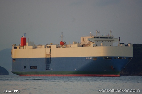
 SALVIA ACE
Current Status
Where is the vessel?
SALVIA ACE is currently in Near Chermside, based on AIS data received about 1h ago.
Latest AIS update:
Current position: 27.37976° S, 153.16463° E (Near Chermside)
Average speed (last 7 days): Loading…
Average speed (last 30 days): Loading…
Vessel profile: SALVIA ACE is a Vehicles Carrier with dimensions 28m x 186m.
This page combines live AIS, route history, probable destination signals, nearby traffic, and port activity for practical vessel monitoring.
The current position of vessel SALVIA ACE is -27.37976 lat / 153.16463 lng. Updated: 2026-05-13 12:21:35 UTCNearest reference points:
- Near Wynnum West
- Near Hemmant
- Near Eagle Farm
Currently sailing under the flag of Japan ![]()
SALVIA ACE built in 2008 year
Deadweight:
15013 tDetails:
Live Vessel SALVIA ACE Analytics (details, animations, etc.)
Recent AIS points (UTC):
2026-05-13 07:30:16 UTC · -27.37976, 153.16478 · SOG 0 kn · COG 38°2026-05-13 09:36:33 UTC · -27.37975, 153.16467 · SOG 0 kn · COG 38°
2026-05-13 10:24:34 UTC · -27.37972, 153.16470 · SOG 0 kn · COG 38°
2026-05-13 12:21:35 UTC · -27.37976, 153.16463 · SOG 0 kn · COG 38°