 vesseltracker.com
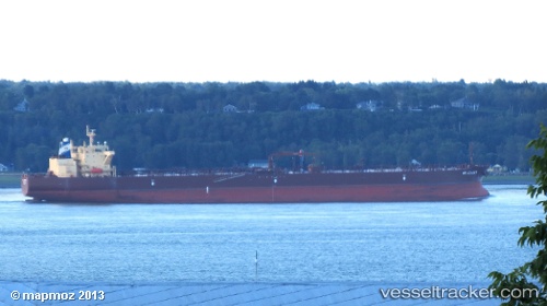
 LIPETSK
Current Status
Where is the vessel?
LIPETSK is currently in 35 nm E of SHIDAO, based on AIS data received less than 1h ago.
Latest AIS update:
Current position: 36.73146° N, 123.15875° E (35 nm E of SHIDAO)
Average speed (last 7 days): Loading…
Average speed (last 30 days): Loading…
Vessel profile: LIPETSK is a Crude Oil Tanker with dimensions m x m.
This page combines live AIS, route history, probable destination signals, nearby traffic, and port activity for practical vessel monitoring.
The current position of vessel LIPETSK is 36.73146 lat / 123.15875 lng. Updated: 2026-05-02 22:26:55 UTCNearest reference points:
- 32 nm E of SHIDAO
- 34 nm SE of SHIDAO
- 20 nm E of SHIDAO
Currently sailing under the flag of Russia ![]()
Details:
Live Vessel LIPETSK Analytics (details, animations, etc.)
Recent AIS points (UTC):
2026-05-02 19:22:15 UTC · 36.64652, 122.60937 · SOG 0.1 kn · COG 99°2026-05-02 19:34:14 UTC · 36.64828, 122.60977 · SOG 0.5 kn · COG 106°
2026-05-02 21:48:35 UTC · 36.65060, 123.03132 · SOG 11.8 kn · COG 87°
2026-05-02 22:26:55 UTC · 36.73146, 123.15875 · SOG 12.8 kn · COG 29°