 vesseltracker.com
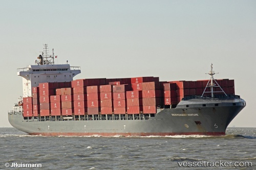
 ARTEMIS
Current Status
Where is the vessel?
ARTEMIS is currently in Near Bahía Las Minas, based on AIS data received less than 1h ago.
Latest AIS update:
Current position: 9.44757° N, 79.85036° W (Near Bahía Las Minas)
Average speed (last 7 days): Loading…
Average speed (last 30 days): Loading…
Vessel profile: ARTEMIS is a Container Ship with dimensions 30m x 209m.
This page combines live AIS, route history, probable destination signals, nearby traffic, and port activity for practical vessel monitoring.
The current position of vessel ARTEMIS is 9.44757 lat / -79.85036 lng. Updated: 2026-05-14 00:20:56 UTCNearest reference points:
- Near COLON 2000
- Near Colon
- Near Colón Free Zone
Currently sailing under the flag of Liberia ![]()
ARTEMIS built in 2008 year
Deadweight:
34438 tDetails:
Live Vessel ARTEMIS Analytics (details, animations, etc.)
Recent AIS points (UTC):
2026-05-13 19:47:47 UTC · 9.44764, -79.85010 · SOG 0.5 kn · COG 352°2026-05-13 21:38:55 UTC · 9.44765, -79.84999 · SOG 0.1 kn · COG 342°
2026-05-13 23:02:51 UTC · 9.44768, -79.85004 · SOG 0.2 kn · COG 343°
2026-05-14 00:20:56 UTC · 9.44757, -79.85036 · SOG 0 kn · COG 356°