 vesseltracker.com
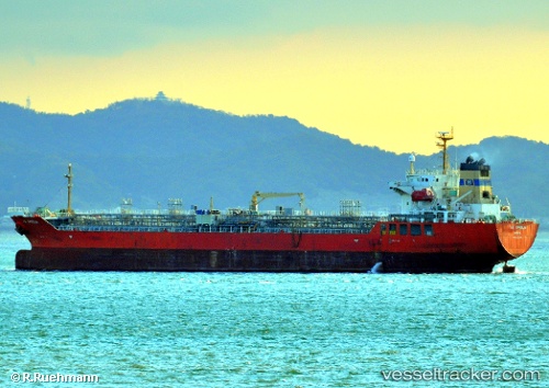
 NO. 2 OCEAN PIONEER
Current Status
Where is the vessel?
NO. 2 OCEAN PIONEER is currently in 12 nm W of JABAL AZ ZANNAH, based on AIS data received about 1d ago.
Latest AIS update:
Current position: 24.15123° N, 52.37007° E (12 nm W of JABAL AZ ZANNAH)
Average speed (last 7 days): Loading…
Average speed (last 30 days): Loading…
Vessel profile: NO. 2 OCEAN PIONEER is a Chemical/Oil Products Tanker with dimensions 24m x 145m.
This page combines live AIS, route history, probable destination signals, nearby traffic, and port activity for practical vessel monitoring.
The current position of vessel NO. 2 OCEAN PIONEER is 24.15123 lat / 52.37007 lng. Updated: 2026-05-15 15:17:58 UTCNearest reference points:
- Near JABAL AZ ZANNAH
- Near Ar Ruways
- Near Yas Island
Currently sailing under the flag of Marshall Islands ![]()
NO. 2 OCEAN PIONEER built in 2006 year
Deadweight:
19991 tDetails:
Live Vessel NO. 2 OCEAN PIONEER Analytics (details, animations, etc.)
Recent AIS points (UTC):
2026-05-15 15:17:58 UTC · 24.15123, 52.37007 · SOG 0.1 kn · COG 316°2026-05-15 15:17:58 UTC · 24.15123, 52.37007 · SOG 0.1 kn · COG 316°
2026-05-15 15:17:58 UTC · 24.15123, 52.37007 · SOG 0.1 kn · COG 316°
2026-05-15 15:17:58 UTC · 24.15123, 52.37007 · SOG 0.1 kn · COG 316°