 vesseltracker.com
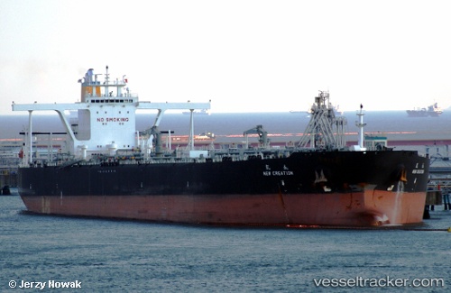
 SEARACER
Current Status
Where is the vessel?
SEARACER is currently in Near Choa Chu Kang, based on AIS data received about 250d ago.
Latest AIS update:
Current position: 1.23987° N, 103.88544° E (Near Choa Chu Kang)
Average speed (last 7 days): Loading…
Average speed (last 30 days): Loading…
Vessel profile: SEARACER is a Crude Oil Tanker with dimensions 330m x 60m.
This page combines live AIS, route history, probable destination signals, nearby traffic, and port activity for practical vessel monitoring.
The current position of vessel SEARACER is 1.23987 lat / 103.88544 lng. Updated: 2025-09-06 03:56:47 UTCNearest reference points:
- Near Choa Chu Kang
- Near Tampines
- Near Singapore
Currently sailing under the flag of Malta ![]()
SEARACER built in 2009 year
Deadweight:
297259 tDetails:
Live Vessel SEARACER Analytics (details, animations, etc.)
Recent AIS points (UTC):
2025-09-06 03:56:47 UTC · 1.23987, 103.88544 · SOG 0.1 kn · COG 183°