 vesseltracker.com
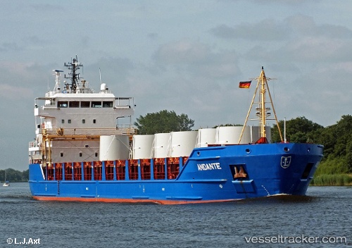
 Danita
Current Status
Where is the vessel?
Danita is currently in Near HELTERMAA, based on AIS data received less than 1h ago.
Latest AIS update:
Current position: 58.86706° N, 23.04777° E (Near HELTERMAA)
Average speed (last 7 days): Loading…
Average speed (last 30 days): Loading…
Vessel profile: Danita is a Multi Purpose Carrier with dimensions 115m x 17m.
This page combines live AIS, route history, probable destination signals, nearby traffic, and port activity for practical vessel monitoring.
The current position of vessel Danita is 58.86706 lat / 23.04777 lng. Updated: 2026-04-26 16:09:40 UTCNearest reference points:
- Near Ristna
- Near Hango
- Near Mahu Sadam
Currently sailing under the flag of Portugal ![]()
Danita built in 2005 year
Deadweight:
6405 tDetails:
Live Vessel Danita Analytics (details, animations, etc.)
Recent AIS points (UTC):
2026-04-26 13:03:58 UTC · 58.86707, 23.04783 · SOG 0 kn · COG 88°2026-04-26 14:15:49 UTC · 58.86703, 23.04793 · SOG 0 kn · COG 88°
2026-04-26 16:09:40 UTC · 58.86706, 23.04777 · SOG 0 kn · COG 88°
2026-04-26 16:09:40 UTC · 58.86706, 23.04777 · SOG 0 kn · COG 88°