 vesseltracker.com
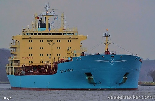
 OM SINGAPORE
Current Status
Where is the vessel?
OM SINGAPORE is currently in Near Fray Luis A. Beltrán, based on AIS data received about 2h ago.
Latest AIS update:
Current position: 32.77355° S, 60.71390° W (Near Fray Luis A. Beltrán)
Average speed (last 7 days): Loading…
Average speed (last 30 days): Loading…
Vessel profile: OM SINGAPORE is a Oil/Chemical Tanker with dimensions m x m.
This page combines live AIS, route history, probable destination signals, nearby traffic, and port activity for practical vessel monitoring.
The current position of vessel OM SINGAPORE is -32.77355 lat / -60.71390 lng. Updated: 2026-05-14 04:15:01 UTCNearest reference points:
- Near Quebracho/San Lorenzo
- Near Puerto Alumbrera
- 10 nm NW of San Pedro
Currently sailing under the flag of Liberia ![]()
Details:
Live Vessel OM SINGAPORE Analytics (details, animations, etc.)
Recent AIS points (UTC):
2026-05-14 01:10:42 UTC · -32.77333, -60.71333 · SOG 0 kn · COG -1°2026-05-14 01:27:02 UTC · -32.77325, -60.71347 · SOG 0 kn · COG 341°
2026-05-14 03:21:01 UTC · -32.77325, -60.71352 · SOG 0 kn · COG 344°
2026-05-14 04:15:01 UTC · -32.77355, -60.71390 · SOG 0.4 kn · COG 343°