 vesseltracker.com
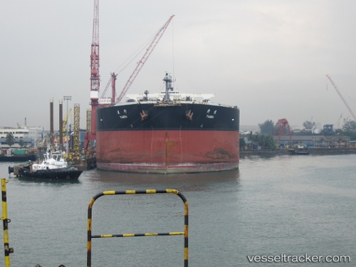
 TAMBA
TAMBA
Current Status
Where is the vessel?
TAMBA is currently in 44 nm W of Belida Terminal, based on AIS data received about 8h ago.
Latest AIS update:
Current position: 4.28584° N, 104.42256° E (44 nm W of Belida Terminal)
Average speed (last 7 days): Loading…
Average speed (last 30 days): Loading…
Vessel profile: TAMBA is a Crude Oil Tanker with dimensions 333m x 60m.
This page combines live AIS, route history, probable destination signals, nearby traffic, and port activity for practical vessel monitoring.
The current position of vessel TAMBA is 4.28584 lat / 104.42256 lng. Updated: 2026-05-14 03:49:19 UTCNearest reference points:
- Near KEMAMAN
- Near Cukai
- 26 nm E of Belida Terminal
Currently sailing under the flag of Liberia ![]()
TAMBA built in 2009 year
Deadweight:
302107 tDetails:
Live Vessel TAMBA Analytics (details, animations, etc.)
Recent AIS points (UTC):
2026-05-14 03:49:19 UTC · 4.28584, 104.42256 · SOG 1.2 kn · COG 308°2026-05-14 03:49:19 UTC · 4.28584, 104.42256 · SOG 1.2 kn · COG 308°
2026-05-14 03:49:19 UTC · 4.28584, 104.42256 · SOG 1.2 kn · COG 308°
2026-05-14 03:49:19 UTC · 4.28584, 104.42256 · SOG 1.2 kn · COG 308°