 vesseltracker.com
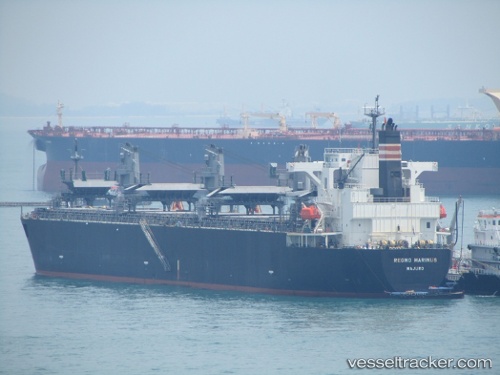
Regno Marinus
Current StatusWhere is the vessel?
Regno Marinus is currently in Near Matosinhos, based on AIS data received less than 1h ago.
Latest AIS update:
Current position: 41.18961° N, 8.68949° W (Near Matosinhos)
Average speed (last 7 days): Loading…
Average speed (last 30 days): Loading…
Vessel profile: Regno Marinus is a Wood Chips Carrier with dimensions 32m x 210m.
This page combines live AIS, route history, probable destination signals, nearby traffic, and port activity for practical vessel monitoring.
The current position of vessel Regno Marinus is 41.18961 lat / -8.68949 lng. Updated: 2026-05-15 15:59:11 UTCNearest reference points:
- Near Matosinhos
- Near POVOA DE VARZIM
- Near Gafanha da Nazaré
Details:
Live Vessel Regno Marinus Analytics (details, animations, etc.)
Recent AIS points (UTC):
2026-05-15 11:44:12 UTC · 41.18959, -8.68951 · SOG 0 kn · COG 269°2026-05-15 13:05:14 UTC · 41.18960, -8.68950 · SOG 0 kn · COG 269°
2026-05-15 13:47:13 UTC · 41.18960, -8.68948 · SOG 0 kn · COG 269°
2026-05-15 15:59:11 UTC · 41.18961, -8.68949 · SOG 0 kn · COG 269°