 vesseltracker.com
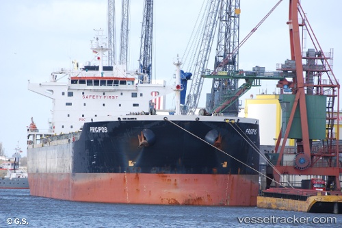
 PRIGIPOS
Current Status
Where is the vessel?
PRIGIPOS is currently in 90 nm NW of Nouadhibou, based on AIS data received about 1h ago.
Latest AIS update:
Current position: 21.64577° N, 18.38207° W (90 nm NW of Nouadhibou)
Average speed (last 7 days): Loading…
Average speed (last 30 days): Loading…
Vessel profile: PRIGIPOS is a Bulk Carrier with dimensions 37m x 229m.
This page combines live AIS, route history, probable destination signals, nearby traffic, and port activity for practical vessel monitoring.
The current position of vessel PRIGIPOS is 21.64577 lat / -18.38207 lng. Updated: 2026-05-14 19:49:10 UTCNearest reference points:
- 41 nm NW of Nouadhibou
- Near Nouadhibou
- Near DAKHLA
Currently sailing under the flag of Liberia ![]()
PRIGIPOS built in 2007 year
Deadweight:
92475 tDetails:
Live Vessel PRIGIPOS Analytics (details, animations, etc.)
Recent AIS points (UTC):
2026-05-14 16:30:23 UTC · 21.20168, -18.60692 · SOG 8.2 kn · COG 29°2026-05-14 17:55:01 UTC · 21.37783, -18.50670 · SOG 8.6 kn · COG 30°
2026-05-14 19:07:51 UTC · 21.54567, -18.42430 · SOG 9.3 kn · COG 25°
2026-05-14 19:49:10 UTC · 21.64577, -18.38207 · SOG 9.4 kn · COG 26°