 vesseltracker.com
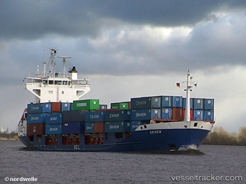
 Deneb J
Current Status
Where is the vessel?
Deneb J is currently in 21 nm SE of Gorda Cay, based on AIS data received less than 1h ago.
Latest AIS update:
Current position: 25.80419° N, 77.28808° W (21 nm SE of Gorda Cay)
Average speed (last 7 days): Loading…
Average speed (last 30 days): Loading…
Vessel profile: Deneb J is a Container Ship with dimensions 139m x 139m.
This page combines live AIS, route history, probable destination signals, nearby traffic, and port activity for practical vessel monitoring.
The current position of vessel Deneb J is 25.80419 lat / -77.28808 lng. Updated: 2026-05-14 21:49:21 UTCNearest reference points:
- 27 nm SE of Gorda Cay
- Near Nassau
- Near Harbour Island
Currently sailing under the flag of Antigua Barbuda ![]()
Deneb J built in 2006 year
Deadweight:
10831 tDetails:
Live Vessel Deneb J Analytics (details, animations, etc.)
Recent AIS points (UTC):
2026-05-14 18:05:14 UTC · 26.04149, -78.29902 · SOG 16 kn · COG 105°2026-05-14 19:37:52 UTC · 25.93473, -77.88416 · SOG 15.1 kn · COG 102°
2026-05-14 19:46:10 UTC · 25.92579, -77.84667 · SOG 15.3 kn · COG 102°
2026-05-14 21:49:21 UTC · 25.80419, -77.28808 · SOG 15 kn · COG 108°