 vesseltracker.com
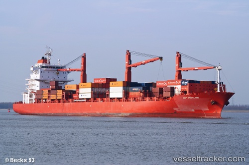
 OKEE GUSTAV
Current Status
Where is the vessel?
OKEE GUSTAV is currently in 71 nm SE of Cozumel, based on AIS data received less than 1h ago.
Latest AIS update:
Current position: 19.55667° N, 86.20667° W (71 nm SE of Cozumel)
Average speed (last 7 days): Loading…
Average speed (last 30 days): Loading…
Vessel profile: OKEE GUSTAV is a Container Ship with dimensions 186m x 28m.
This page combines live AIS, route history, probable destination signals, nearby traffic, and port activity for practical vessel monitoring.
The current position of vessel OKEE GUSTAV is 19.55667 lat / -86.20667 lng. Updated: 2026-05-12 21:56:14 UTCNearest reference points:
- Near Puerto Juárez
- 58 nm S of San Julian
- 14 nm SE of Belize
Currently sailing under the flag of Liberia ![]()
OKEE GUSTAV built in 2007 year
Deadweight:
28142 tDetails:
Live Vessel OKEE GUSTAV Analytics (details, animations, etc.)
Recent AIS points (UTC):
2026-05-12 17:23:12 UTC · 20.49333, -85.74500 · SOG 14 kn · COG -1°2026-05-12 18:59:15 UTC · 20.15667, -85.90500 · SOG 13 kn · COG -1°
2026-05-12 19:35:15 UTC · 20.03333, -85.96500 · SOG 13 kn · COG -1°
2026-05-12 21:56:14 UTC · 19.55667, -86.20667 · SOG 13 kn · COG -1°