 vesseltracker.com
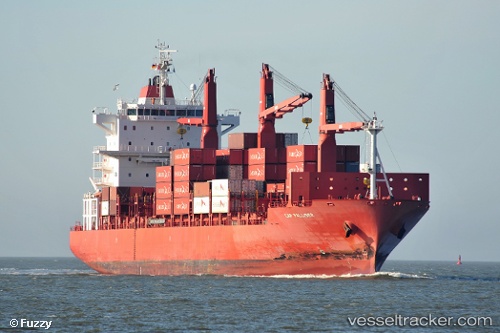
 Cap Palliser
Current Status
Where is the vessel?
Cap Palliser is currently in Near Zhangjiagang, based on AIS data received about 19h ago.
Latest AIS update:
Current position: 31.96497° N, 120.36543° E (Near Zhangjiagang)
Average speed (last 7 days): Loading…
Average speed (last 30 days): Loading…
Vessel profile: Cap Palliser is a Container Ship with dimensions 188m x 28m.
This page combines live AIS, route history, probable destination signals, nearby traffic, and port activity for practical vessel monitoring.
The current position of vessel Cap Palliser is 31.96497 lat / 120.36543 lng. Updated: 2026-05-12 23:42:29 UTCNearest reference points:
- Near Jiangyin Pt
- Near Zhangjiagang
- Near Jingjiang Pt
Currently sailing under the flag of Liberia ![]()
Cap Palliser built in 2007 year
Deadweight:
28219 tDetails:
Live Vessel Cap Palliser Analytics (details, animations, etc.)
Recent AIS points (UTC):
2026-05-12 23:42:29 UTC · 31.96497, 120.36543 · SOG 0 kn · COG 167°2026-05-12 23:42:29 UTC · 31.96497, 120.36543 · SOG 0 kn · COG 167°
2026-05-12 23:42:29 UTC · 31.96497, 120.36543 · SOG 0 kn · COG 167°
2026-05-12 23:42:29 UTC · 31.96497, 120.36543 · SOG 0 kn · COG 167°