 vesseltracker.com
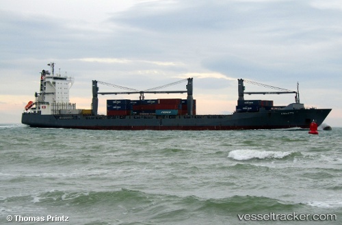
 Violetta
Current Status
Where is the vessel?
Violetta is currently in 26 nm N of Eckerö, based on AIS data received about 2h ago.
Latest AIS update:
Current position: 60.62513° N, 19.28699° E (26 nm N of Eckerö)
Average speed (last 7 days): Loading…
Average speed (last 30 days): Loading…
Vessel profile: Violetta is a Container Ship with dimensions 178m x 27m.
This page combines live AIS, route history, probable destination signals, nearby traffic, and port activity for practical vessel monitoring.
The current position of vessel Violetta is 60.62513 lat / 19.28699 lng. Updated: 2026-05-15 01:15:09 UTCNearest reference points:
- Near MARIEHAMN
- Near GRADDO
- Near Finström
Currently sailing under the flag of Portugal ![]()
Violetta built in 2007 year
Deadweight:
22267 tDetails:
Live Vessel Violetta Analytics (details, animations, etc.)
Recent AIS points (UTC):
2026-05-14 21:35:29 UTC · 61.14764, 20.98776 · SOG 16 kn · COG 256°2026-05-14 22:42:46 UTC · 60.99400, 20.45596 · SOG 16 kn · COG 236°
2026-05-14 23:59:32 UTC · 60.80723, 19.86393 · SOG 16 kn · COG 237°
2026-05-15 01:15:09 UTC · 60.62513, 19.28699 · SOG 16 kn · COG 237°