 vesseltracker.com
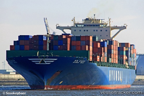
 Hyundai Brave
Current Status
Where is the vessel?
Hyundai Brave is currently in Near Rejected, based on AIS data received less than 1h ago.
Latest AIS update:
Current position: 37.35713° N, 0.66972° W (Near Rejected)
Average speed (last 7 days): Loading…
Average speed (last 30 days): Loading…
Vessel profile: Hyundai Brave is a Container Ship with dimensions 339m x 45m.
This page combines live AIS, route history, probable destination signals, nearby traffic, and port activity for practical vessel monitoring.
The current position of vessel Hyundai Brave is 37.35713 lat / -0.66972 lng. Updated: 2026-04-27 17:03:47 UTCNearest reference points:
- 20 nm S of Rejected
- Near ESCOMBRERAS
- Near Cartagena
Currently sailing under the flag of Marshall Is ![]()
Hyundai Brave built in 2007 year
Deadweight:
99123 tDetails:
Live Vessel Hyundai Brave Analytics (details, animations, etc.)
Recent AIS points (UTC):
2026-04-27 11:58:57 UTC · 37.41547, -0.50313 · SOG 4.8 kn · COG 239°2026-04-27 13:24:38 UTC · 37.39066, -0.53750 · SOG 1 kn · COG 122°
2026-04-27 15:37:27 UTC · 37.38472, -0.60952 · SOG 1.4 kn · COG 128°
2026-04-27 17:03:47 UTC · 37.35713, -0.66972 · SOG 8.7 kn · COG 265°