 vesseltracker.com
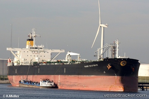
 SOLVANTE
Current Status
Where is the vessel?
SOLVANTE is currently in 14 nm NW of Sosnovyy Bor, based on AIS data received about 2h ago.
Latest AIS update:
Current position: 59.99976° N, 28.69029° E (14 nm NW of Sosnovyy Bor)
Average speed (last 7 days): Loading…
Average speed (last 30 days): Loading…
Vessel profile: SOLVANTE is a Crude Oil Tanker with dimensions m x m.
This page combines live AIS, route history, probable destination signals, nearby traffic, and port activity for practical vessel monitoring.
The current position of vessel SOLVANTE is 59.99976 lat / 28.69029 lng. Updated: 2026-05-14 16:18:00 UTCNearest reference points:
- 10 nm NE of VISTINO
- 11 nm NE of VISTINO
- Near VISTINO
Currently sailing under the flag of Barbados ![]()
Details:
Live Vessel SOLVANTE Analytics (details, animations, etc.)
Recent AIS points (UTC):
2026-05-14 13:49:40 UTC · 60.00493, 28.69459 · SOG 0.2 kn · COG 16°2026-05-14 16:02:20 UTC · 60.00036, 28.69070 · SOG 0.1 kn · COG 324°
2026-05-14 16:07:10 UTC · 60.00017, 28.69061 · SOG 0.1 kn · COG 326°
2026-05-14 16:18:00 UTC · 59.99976, 28.69029 · SOG 0.2 kn · COG 328°