 vesseltracker.com
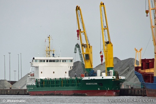
 Bremer Elena
Current Status
Where is the vessel?
Bremer Elena is currently in 31 nm W of Punta de Piedras, based on AIS data received about 1h ago.
Latest AIS update:
Current position: 10.82330° N, 64.62530° W (31 nm W of Punta de Piedras)
Average speed (last 7 days): Loading…
Average speed (last 30 days): Loading…
Vessel profile: Bremer Elena is a Multi Purpose Carrier with dimensions 90m x 16m.
This page combines live AIS, route history, probable destination signals, nearby traffic, and port activity for practical vessel monitoring.
The current position of vessel Bremer Elena is 10.8233 lat / -64.6253 lng. Updated: 2026-05-15 04:54:59 UTCNearest reference points:
- 15 nm SW of Punta de Piedras
- Near Puerto Sucre
Currently sailing under the flag of Germany ![]()
Bremer Elena built in 2007 year
Deadweight:
4316 tDetails:
Live Vessel Bremer Elena Analytics (details, animations, etc.)
Recent AIS points (UTC):
2026-05-15 01:21:42 UTC · 11.14090, -64.76120 · SOG 7.2 kn · COG 244°2026-05-15 04:01:22 UTC · 10.90360, -64.69030 · SOG 7 kn · COG 134°
2026-05-15 04:01:22 UTC · 10.90360, -64.69030 · SOG 7 kn · COG 134°
2026-05-15 04:54:59 UTC · 10.82330, -64.62530 · SOG 7.2 kn · COG 127°