 vesseltracker.com
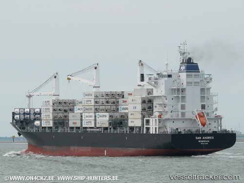
San Andres
Current StatusWhere is the vessel?
San Andres is currently in Near Kiziltoprak, based on AIS data received less than 1h ago.
Latest AIS update:
Current position: 40.94966° N, 28.98327° E (Near Kiziltoprak)
Average speed (last 7 days): Loading…
Average speed (last 30 days): Loading…
Vessel profile: San Andres is a Container Ship with dimensions 28m x 186m.
This page combines live AIS, route history, probable destination signals, nearby traffic, and port activity for practical vessel monitoring.
The current position of vessel San Andres is 40.94966 lat / 28.98327 lng. Updated: 2026-05-14 10:03:57 UTCNearest reference points:
- Near Kiziltoprak
- Near ZEYTINBURNU
- Near Davutpasa
Details:
Live Vessel San Andres Analytics (details, animations, etc.)
Recent AIS points (UTC):
2026-05-14 07:22:50 UTC · 40.77599, 28.84625 · SOG 0.7 kn · COG 306°2026-05-14 07:25:50 UTC · 40.77521, 28.84630 · SOG 0.9 kn · COG 309°
2026-05-14 09:33:58 UTC · 40.89147, 28.93006 · SOG 6.5 kn · COG 50°
2026-05-14 10:03:57 UTC · 40.94966, 28.98327 · SOG 6.8 kn · COG 20°