 vesseltracker.com
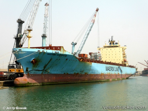
 Maersk Inverness
Current Status
Where is the vessel?
Maersk Inverness is currently in 249 nm E of Bicheno, based on AIS data received about 1h ago.
Latest AIS update:
Current position: 41.44024° S, 153.80228° E (249 nm E of Bicheno)
Average speed (last 7 days): Loading…
Average speed (last 30 days): Loading…
Vessel profile: Maersk Inverness is a Container Ship with dimensions 233m x 233m.
This page combines live AIS, route history, probable destination signals, nearby traffic, and port activity for practical vessel monitoring.
The current position of vessel Maersk Inverness is -41.44024 lat / 153.80228 lng. Updated: 2026-05-13 23:18:56 UTCCurrently sailing under the flag of Singapore ![]()
Maersk Inverness built in 2008 year
Deadweight:
41350 tDetails:
Live Vessel Maersk Inverness Analytics (details, animations, etc.)
Recent AIS points (UTC):
2026-05-13 20:04:09 UTC · -41.15416, 153.11339 · SOG 10.7 kn · COG 118°2026-05-13 22:06:20 UTC · -41.33317, 153.54086 · SOG 10.8 kn · COG 116°
2026-05-13 22:06:20 UTC · -41.33317, 153.54086 · SOG 10.8 kn · COG 116°
2026-05-13 23:18:56 UTC · -41.44024, 153.80228 · SOG 11 kn · COG 113°