 vesseltracker.com
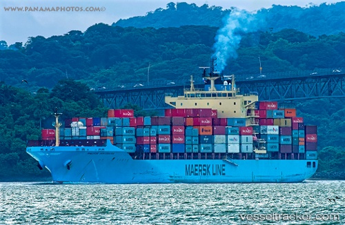
Maersk Innoshima
Current StatusWhere is the vessel?
Maersk Innoshima is currently in 171 nm W of Wanam, based on AIS data received about 1h ago.
Latest AIS update:
Current position: 8.34500° S, 136.33333° E (171 nm W of Wanam)
Average speed (last 7 days): Loading…
Average speed (last 30 days): Loading…
Vessel profile: Maersk Innoshima is a Container Ship with dimensions 32m x 233m.
This page combines live AIS, route history, probable destination signals, nearby traffic, and port activity for practical vessel monitoring.
The current position of vessel Maersk Innoshima is -8.34500 lat / 136.33333 lng. Updated: 2026-05-14 07:47:02 UTCNearest reference points:
- 131 nm SW of Wanam
- 137 nm N of Elizabeth Bay
Details:
Live Vessel Maersk Innoshima Analytics (details, animations, etc.)
Recent AIS points (UTC):
2026-05-14 04:23:00 UTC · -7.59167, 135.99667 · SOG 14 kn · COG -1°2026-05-14 06:32:00 UTC · -8.07167, 136.20667 · SOG 14 kn · COG -1°
2026-05-14 07:35:01 UTC · -8.30166, 136.31168 · SOG 14 kn · COG -1°
2026-05-14 07:47:02 UTC · -8.34500, 136.33333 · SOG 14 kn · COG -1°