 vesseltracker.com
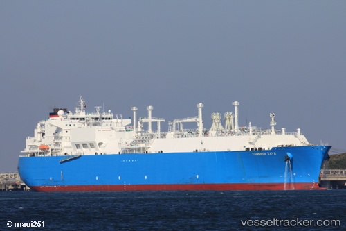
Tangguh Jaya
Current StatusWhere is the vessel?
Tangguh Jaya is currently in 59 nm NE of KIJANG, based on AIS data received less than 1h ago.
Latest AIS update:
Current position: 1.45500° N, 105.38500° E (59 nm NE of KIJANG)
Average speed (last 7 days): Loading…
Average speed (last 30 days): Loading…
Vessel profile: Tangguh Jaya is a Lng Tanker with dimensions 43m x 285m.
This page combines live AIS, route history, probable destination signals, nearby traffic, and port activity for practical vessel monitoring.
The current position of vessel Tangguh Jaya is 1.45500 lat / 105.38500 lng. Updated: 2026-05-13 22:17:10 UTCNearest reference points:
- 76 nm NE of KIJANG
- 47 nm NE of PENGERANG
- 38 nm E of PENGERANG
Details:
Live Vessel Tangguh Jaya Analytics (details, animations, etc.)
Recent AIS points (UTC):
2026-05-13 19:17:15 UTC · 1.02500, 105.78167 · SOG 11 kn · COG -1°2026-05-13 20:02:11 UTC · 1.13333, 105.68667 · SOG 11 kn · COG -1°
2026-05-13 22:02:11 UTC · 1.41833, 105.41833 · SOG 11 kn · COG -1°
2026-05-13 22:17:10 UTC · 1.45500, 105.38500 · SOG 11 kn · COG -1°