 DE TIAN
Current Status
Where is the vessel?
DE TIAN is currently in Near Strait Of Gibraltar, based on AIS data received about 15h ago.
Latest AIS update:
Current position: 35.99116° N, 5.94682° W (Near Strait Of Gibraltar)
Average speed (last 7 days): Loading…
Average speed (last 30 days): Loading…
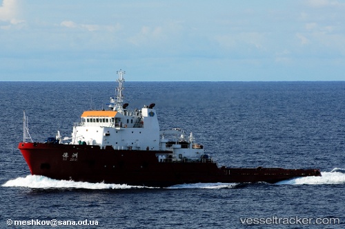
Vessel profile: DE TIAN is a Offshore Tug/Supply Ship with dimensions 17m x 89m.
This page combines live AIS, route history, probable destination signals, nearby traffic, and port activity for practical vessel monitoring.
The current position of vessel DE TIAN is 35.99116 lat / -5.94682 lng. Updated: 2026-05-23 17:21:48 UTCNearest reference points:
- Near TARIFA
- Near Conil de la Frontera
- Near Gibraltar
Currently sailing under the flag of China Peopless Republic ![]()
DE TIAN built in 2007 year
Deadweight:
3266 tDetails:
Live Vessel DE TIAN Analytics (details, animations, etc.)
Recent AIS points (UTC):
2026-05-23 13:59:49 UTC · 36.09646, -5.37837 · SOG 6.1 kn · COG 179°2026-05-23 16:18:48 UTC · 35.96055, -5.73331 · SOG 10.5 kn · COG 269°
2026-05-23 16:25:58 UTC · 35.96054, -5.75930 · SOG 10.1 kn · COG 269°
2026-05-23 17:21:48 UTC · 35.99116, -5.94682 · SOG 10 kn · COG 289°