 vesseltracker.com
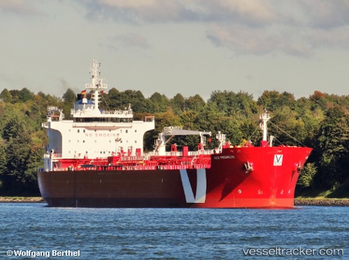
 Noreaster
Current Status
Where is the vessel?
Noreaster is currently in Near Searsport, based on AIS data received less than 1h ago.
Latest AIS update:
Current position: 44.45101° N, 68.89794° W (Near Searsport)
Average speed (last 7 days): Loading…
Average speed (last 30 days): Loading…
Vessel profile: Noreaster is a Chemical Oil Products Tanker with dimensions 184m x 27m.
This page combines live AIS, route history, probable destination signals, nearby traffic, and port activity for practical vessel monitoring.
The current position of vessel Noreaster is 44.45101 lat / -68.89794 lng. Updated: 2026-05-16 15:28:29 UTCNearest reference points:
- Near ROCKPORT
- Near Surry
- Near Manset
Currently sailing under the flag of Marshall Is ![]()
Noreaster built in 2007 year
Deadweight:
37412 tDetails:
Live Vessel Noreaster Analytics (details, animations, etc.)
Recent AIS points (UTC):
2026-05-16 11:34:29 UTC · 44.45097, -68.89794 · SOG 0 kn · COG 342°2026-05-16 13:16:29 UTC · 44.45098, -68.89794 · SOG 0 kn · COG 342°
2026-05-16 13:25:29 UTC · 44.45096, -68.89790 · SOG 0 kn · COG 342°
2026-05-16 15:28:29 UTC · 44.45101, -68.89794 · SOG 0 kn · COG 342°