 vesseltracker.com
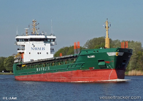
 ALAND
ALAND
Current Status
Where is the vessel?
ALAND is currently in Near HONFLEUR AVANT-PORT, based on AIS data received less than 1h ago.
Latest AIS update:
Current position: 49.42848° N, 0.24755° E (Near HONFLEUR AVANT-PORT)
Average speed (last 7 days): Loading…
Average speed (last 30 days): Loading…
Vessel profile: ALAND is a General Cargo Ship with dimensions 117m x 17m.
This page combines live AIS, route history, probable destination signals, nearby traffic, and port activity for practical vessel monitoring.
The current position of vessel ALAND is 49.42848 lat / 0.24755 lng. Updated: 2026-04-30 00:04:37 UTCNearest reference points:
- Near Le Havre
- Near TROUVILLE-SUR-MER
- Near Caen
Currently sailing under the flag of Portugal (MAR) ![]()
ALAND built in 2007 year
Deadweight:
7056 tDetails:
Live Vessel ALAND Analytics (details, animations, etc.)
Recent AIS points (UTC):
2026-04-29 20:04:40 UTC · 49.42847, 0.24756 · SOG 0 kn · COG 268°2026-04-29 22:10:40 UTC · 49.42847, 0.24756 · SOG 0 kn · COG 268°
2026-04-29 22:13:39 UTC · 49.42847, 0.24757 · SOG 0 kn · COG 268°
2026-04-30 00:04:37 UTC · 49.42848, 0.24755 · SOG 0 kn · COG 268°