 vesseltracker.com
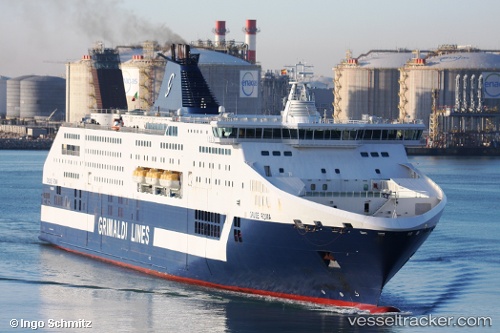
 Cruise Roma
Current Status
Where is the vessel?
Cruise Roma is currently in Near Civitavecchia, based on AIS data received less than 1h ago.
Latest AIS update:
Current position: 42.09830° N, 11.78067° E (Near Civitavecchia)
Average speed (last 7 days): Loading…
Average speed (last 30 days): Loading…
Vessel profile: Cruise Roma is a Passenger Ro Ro Cargo Ship with dimensions 254m x 30m.
This page combines live AIS, route history, probable destination signals, nearby traffic, and port activity for practical vessel monitoring.
The current position of vessel Cruise Roma is 42.09830 lat / 11.78067 lng. Updated: 2026-04-27 19:27:30 UTCNearest reference points:
- Near Civitavecchia
- Near Santa Marinella
- Near Tarquinia
Currently sailing under the flag of Italy ![]()
Cruise Roma built in 2008 year
Deadweight:
7500 tDetails:
Live Vessel Cruise Roma Analytics (details, animations, etc.)
Recent AIS points (UTC):
2026-04-27 16:12:30 UTC · 42.09829, 11.78071 · SOG 0 kn · COG 218°2026-04-27 16:48:29 UTC · 42.09832, 11.78068 · SOG 0 kn · COG 219°
2026-04-27 17:42:29 UTC · 42.09830, 11.78072 · SOG 0 kn · COG 218°
2026-04-27 19:27:30 UTC · 42.09830, 11.78067 · SOG 0 kn · COG 220°