 vesseltracker.com
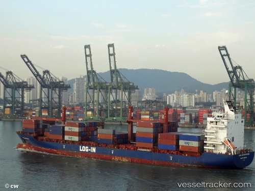
 Log In Pantanal
Current Status
Where is the vessel?
Log In Pantanal is currently in Near Guarujá, based on AIS data received about 1h ago.
Latest AIS update:
Current position: 24.12050° S, 46.19049° W (Near Guarujá)
Average speed (last 7 days): Loading…
Average speed (last 30 days): Loading…
Vessel profile: Log In Pantanal is a Container Ship with dimensions 182m x 25m.
This page combines live AIS, route history, probable destination signals, nearby traffic, and port activity for practical vessel monitoring.
The current position of vessel Log In Pantanal is -24.12050 lat / -46.19049 lng. Updated: 2026-05-14 06:27:54 UTCNearest reference points:
- Near Guarujá
- Near Santos
- 30 nm SE of Guarujá
Currently sailing under the flag of Brazil ![]()
Log In Pantanal built in 2007 year
Deadweight:
23821 tDetails:
Live Vessel Log In Pantanal Analytics (details, animations, etc.)
Recent AIS points (UTC):
2026-05-13 23:33:50 UTC · -24.11983, -46.19416 · SOG 0.3 kn · COG 105°2026-05-14 05:18:52 UTC · -24.11866, -46.19230 · SOG 0.3 kn · COG 174°
2026-05-14 06:27:54 UTC · -24.12050, -46.19049 · SOG 0.5 kn · COG 268°
2026-05-14 06:27:54 UTC · -24.12050, -46.19049 · SOG 0.5 kn · COG 268°