 vesseltracker.com
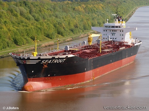
 Seatrout
Current Status
Where is the vessel?
Seatrout is currently in 11 nm SW of Santiago do Cacém, based on AIS data received less than 1h ago.
Latest AIS update:
Current position: 37.89072° N, 8.87320° W (11 nm SW of Santiago do Cacém)
Average speed (last 7 days): Loading…
Average speed (last 30 days): Loading…
Vessel profile: Seatrout is a Oil Products Tanker with dimensions 188m x 32m.
This page combines live AIS, route history, probable destination signals, nearby traffic, and port activity for practical vessel monitoring.
The current position of vessel Seatrout is 37.89072 lat / -8.87320 lng. Updated: 2026-04-06 12:20:52 UTCNearest reference points:
- Near Sesimbra
- Near Palmela
- Near Lagos
Currently sailing under the flag of Germany ![]()
Seatrout built in 2006 year
Deadweight:
40600 tDetails:
Live Vessel Seatrout Analytics (details, animations, etc.)
Recent AIS points (UTC):
2026-04-06 05:29:54 UTC · 37.88901, -8.87490 · SOG 0.1 kn · COG 113°2026-04-06 07:36:51 UTC · 37.88974, -8.87408 · SOG 0.2 kn · COG 155°
2026-04-06 10:23:01 UTC · 37.89066, -8.87343 · SOG 0.1 kn · COG 169°
2026-04-06 12:20:52 UTC · 37.89072, -8.87320 · SOG 0 kn · COG 171°