 vesseltracker.com
 WADI BANI KHALID
Current Status
Where is the vessel?
WADI BANI KHALID is currently in 272 nm SW of Volcano, based on AIS data received about 1h ago.
Latest AIS update:
Current position: 34.85367° N, 133.09105° W (272 nm SW of Volcano)
Average speed (last 7 days): Loading…
Average speed (last 30 days): Loading…
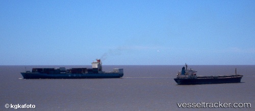
Vessel profile: WADI BANI KHALID is a Container Ship with dimensions 260m x 32m.
This page combines live AIS, route history, probable destination signals, nearby traffic, and port activity for practical vessel monitoring.
The current position of vessel WADI BANI KHALID is 34.85367 lat / -133.09105 lng. Updated: 2026-04-28 20:06:40 UTCCurrently sailing under the flag of Marshall Islands ![]()
WADI BANI KHALID built in 2008 year
Deadweight:
50596 tDetails:
Live Vessel WADI BANI KHALID Analytics (details, animations, etc.)
Recent AIS points (UTC):
2026-04-28 15:51:10 UTC · 35.34783, -134.22588 · SOG 15 kn · COG 114°2026-04-28 16:37:53 UTC · 35.26208, -134.01518 · SOG 14.9 kn · COG 115°
2026-04-28 17:41:08 UTC · 35.13992, -133.73538 · SOG 15 kn · COG 116°
2026-04-28 20:06:40 UTC · 34.85367, -133.09105 · SOG 14.7 kn · COG 117°