 vesseltracker.com
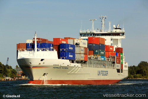
 Henneke Rambow
Current Status
Where is the vessel?
Henneke Rambow is currently in Near ALGER, based on AIS data received less than 1h ago.
Latest AIS update:
Current position: 36.76870° N, 3.06448° E (Near ALGER)
Average speed (last 7 days): Loading…
Average speed (last 30 days): Loading…
Vessel profile: Henneke Rambow is a Container Ship with dimensions 135m x 23m.
This page combines live AIS, route history, probable destination signals, nearby traffic, and port activity for practical vessel monitoring.
The current position of vessel Henneke Rambow is 36.7687 lat / 3.06448 lng. Updated: 2026-05-14 21:56:30 UTCNearest reference points:
- Near Algiers
- 16 nm NE of Berja
- 17 nm S of Albanchez
Currently sailing under the flag of Germany ![]()
Henneke Rambow built in 2007 year
Deadweight:
11274 tDetails:
Live Vessel Henneke Rambow Analytics (details, animations, etc.)
Recent AIS points (UTC):
2026-05-14 17:23:31 UTC · 36.76870, 3.06449 · SOG 0 kn · COG 195°2026-05-14 19:41:30 UTC · 36.76870, 3.06451 · SOG 0 kn · COG 195°
2026-05-14 19:59:31 UTC · 36.76860, 3.06451 · SOG 0 kn · COG 195°
2026-05-14 21:56:30 UTC · 36.76870, 3.06448 · SOG 0 kn · COG 195°