 vesseltracker.com
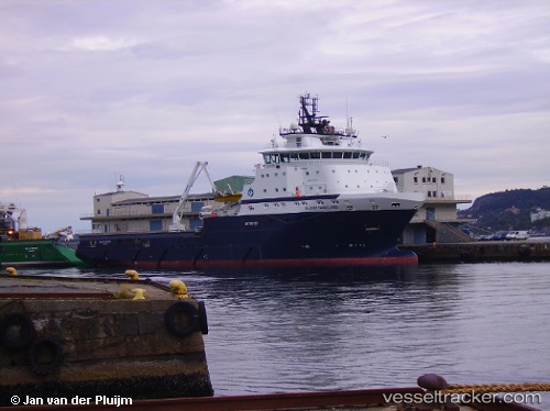
Island Vanguard
Current StatusWhere is the vessel?
Island Vanguard is currently in Near Damsgård, based on AIS data received less than 1h ago.
Latest AIS update:
Current position: 60.38867° N, 5.31102° E (Near Damsgård)
Average speed (last 7 days): Loading…
Average speed (last 30 days): Loading…
Vessel profile: Island Vanguard is a Offshore Tug Supply Ship with dimensions 22m x 86m.
This page combines live AIS, route history, probable destination signals, nearby traffic, and port activity for practical vessel monitoring.
The current position of vessel Island Vanguard is 60.38867 lat / 5.31102 lng. Updated: 2026-05-15 07:37:18 UTCNearest reference points:
- Near Bergen
- Near Damsgård
- Near Skålevik
Details:
Live Vessel Island Vanguard Analytics (details, animations, etc.)
Recent AIS points (UTC):
2026-05-15 04:40:55 UTC · 60.38846, 5.31132 · SOG 0 kn · COG 131°2026-05-15 06:16:51 UTC · 60.38847, 5.31134 · SOG 0 kn · COG 132°
2026-05-15 07:10:14 UTC · 60.38871, 5.31104 · SOG 0 kn · COG 314°
2026-05-15 07:37:18 UTC · 60.38867, 5.31102 · SOG 0 kn · COG 312°