 vesseltracker.com
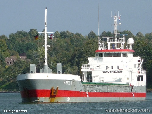
 Hekla
Hekla
Current Status
Where is the vessel?
Hekla is currently in Near ROTTERDAM PERNIS, based on AIS data received about 1h ago.
Latest AIS update:
Current position: 51.88021° N, 4.39334° E (Near ROTTERDAM PERNIS)
Average speed (last 7 days): Loading…
Average speed (last 30 days): Loading…
Vessel profile: Hekla is a General Cargo Ship with dimensions 89m x 12m.
This page combines live AIS, route history, probable destination signals, nearby traffic, and port activity for practical vessel monitoring.
The current position of vessel Hekla is 51.88021 lat / 4.39334 lng. Updated: 2026-05-14 20:04:37 UTCNearest reference points:
- Near ROTTERDAM PERNIS
- Near Heijplaat
- Near Pernis
Currently sailing under the flag of Netherlands ![]()
Hekla built in 2008 year
Deadweight:
3150 tDetails:
Live Vessel Hekla Analytics (details, animations, etc.)
Recent AIS points (UTC):
2026-05-14 16:16:35 UTC · 51.88020, 4.39327 · SOG 0 kn · COG 172°2026-05-14 17:25:32 UTC · 51.88019, 4.39326 · SOG 0 kn · COG 172°
2026-05-14 19:43:37 UTC · 51.88025, 4.39325 · SOG 0 kn · COG 172°
2026-05-14 20:04:37 UTC · 51.88021, 4.39334 · SOG 0 kn · COG 172°