 vesseltracker.com
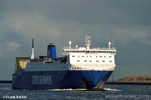
 CORONA SEA
Current Status
Where is the vessel?
CORONA SEA is currently in 17 nm N of Zingst, based on AIS data received about 1h ago.
Latest AIS update:
Current position: 54.70952° N, 12.65706° E (17 nm N of Zingst)
Average speed (last 7 days): Loading…
Average speed (last 30 days): Loading…
Vessel profile: CORONA SEA is a Vehicles Carrier with dimensions m x m.
This page combines live AIS, route history, probable destination signals, nearby traffic, and port activity for practical vessel monitoring.
The current position of vessel CORONA SEA is 54.70952 lat / 12.65706 lng. Updated: 2026-05-17 20:09:16 UTCNearest reference points:
- Near Pruchten
- Near Schmedshagen
- Near Rødvig Havn
Currently sailing under the flag of Portugal ![]()
Details:
Live Vessel CORONA SEA Analytics (details, animations, etc.)
Recent AIS points (UTC):
2026-05-17 16:19:02 UTC · 54.13921, 11.33583 · SOG 16.9 kn · COG 62°2026-05-17 18:07:44 UTC · 54.35544, 12.02873 · SOG 14.4 kn · COG 62°
2026-05-17 19:32:02 UTC · 54.61711, 12.43078 · SOG 15.6 kn · COG 54°
2026-05-17 20:09:16 UTC · 54.70952, 12.65706 · SOG 15.3 kn · COG 66°